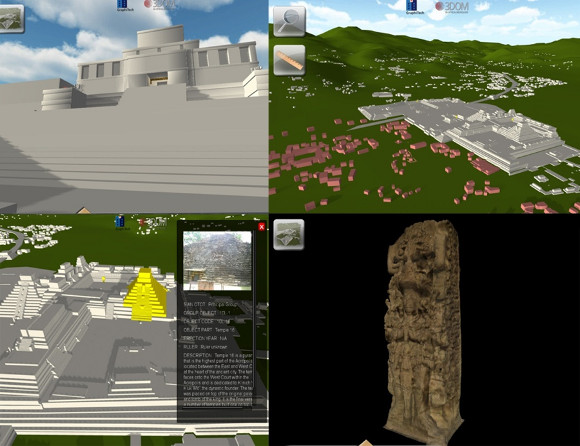
Figure 1: QueryArch3D Beta Version 1.0 showing different visualization and query tools in the 3D browser
Project Summary
The goal of the MayaArch3D project is to develop a new research tool that offers the possibility to combine 3D-Models and the functions of Geographical Information Systems (GIS) for the documentation and analysis of archaeological sites on one internet platform. Two and three-dimensional data and models of different size and resolution will be integrated in a Geodatainfrastructure (GDI) with web-based, interactive features for analysis and visualization. Until now the online analysis of maps of settlements, their access and visibility, topography, architectural and landscape alignments, and spatio-temporal distribution of features was only conducted in 2D or 2.5D-views, now it will be possible in a 3D environment. In this way, information and objects that are housed in disparate collections around the world can be documented, geo-referenced, virtually combined and analyzed on one platform according to international data sharing and data security standards.
The research site is the ancient Maya kingdom and UNESCO cultural heritage site of Copan, Honduras. The tool – called QueryArch3D – is a prototype that can be adapted for use at other complex archaeological sites worldwide.
Methods
Current work focuses on the collection and structuring of archaeological data, and the development of digital tools to permit complex analyses for applied research. Compatible 2D and 3D-Browsers are being developed to interact with each other for a broader range of queries and analyses. By using virtual landscapes and GIS-maps that are linked to searchable databases, researchers will be able to carry out interactive analyses to evaluate architecture and landscape as an integrated system and identify relations and changes in space and time.

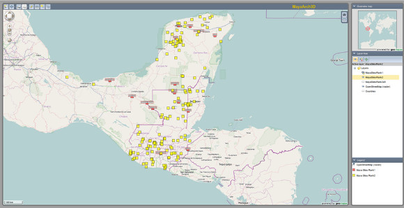
Figure 2: 2D Geobrowser with selected archaeological sites highlighted

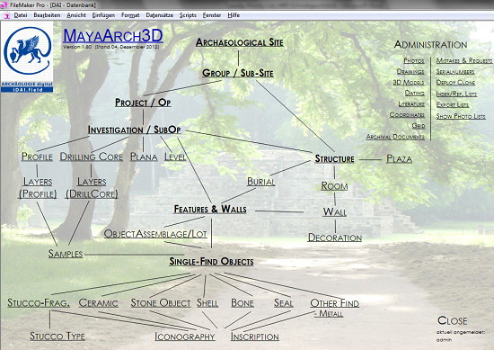
Figure 3: Start page of the German Archaeological Institute’s web-based database showing Table Relations
Existing Resources
Data
- A Geographic Information System (GIS) and a 3D virtual urban landscape that combines 24 square kilometers and 3000 structures of the Copan valley (Richards-Rissetto 2010) [1]
- 3D-Models of sculpture and architecture from Copan, made in 2009 made with a laserscanner and photogrammetry, as test objects for the 3D-documentation system (Remondino et al. 2009, von Schwerin et al. 2011) [2,3].
- Digital images of Artifacts and Architecture from Honduran archaeology with a focus on Copan, Late Classic period – AD 600-900 (formats: JPG, TIFF, png, VRML, point clouds,.obj.)
Software
- i.DAIfield- the database of the German Archaeological Institute (DAI) is being adapted for the needs of archaeologists and cultural heritage managers working at ancient Maya and non-Maya sites in Honduras, as well for the administration of metadata on 3D models.
- Geomajas – Open-Source-GIS-Framework for the web. This will function as the display browser for the 2D and 2.5D Geodata.
- QueryArch3D 1.0- a prototype of a web based Query system of 3D-Objects, was constructed with the platform Unity3D in an earlier pilot project (Agugiaro et al. 2011)[4]. The beta-test results of this system are being used to design a new 3D browser.
- Three.js- JavaScript-library in combination with WebGL. This combination serves as a framework for the development of the new, web-based 3D-environment (Auer, M. 2012) [5].
New Resources to be developed
Data
- A database with geo-referenced information about archaeological sites in Honduras, with highly detailed information on Copan containing data on architecture, objects, iconography and inscriptions from the 8th and 9th centuries, as well as 3D-Models, created by remote sensing techniques (i.e. photogrammetry, 3D-laserscanning and aerial photographs).
New Tool
- A 3D Geographic Information System (3DGIS) for modelling and georeferencing of information with decentralized, web-based access so that groups of researchers simultaneously will be able to access the data. An important project task is to develop a user management system with a range of access levels, and import and export functions for different 3D-data types according to international standards.
- A new 3D-Database and user interface based on open-source software will be developed as an alternative to the proprietary Unity3D software used in the current prototype.
- A pipeline for communication between the i.DAIfield database (Filemaker Pro) and the 3D Objects database (Postgresql/PostGIS).
- 3D query and analysis instruments that are useful for a range of archaeological research questions like the analysis of visibility maps, settlements, topography, alignments, and spatial and temporal arrangements of features, objects, iconography, inscriptions.
